This is some text inside of a div block.
local_shipping
Logistics
arrow_forward

Logistics runs on location.
Every route, every depot, every delivery.

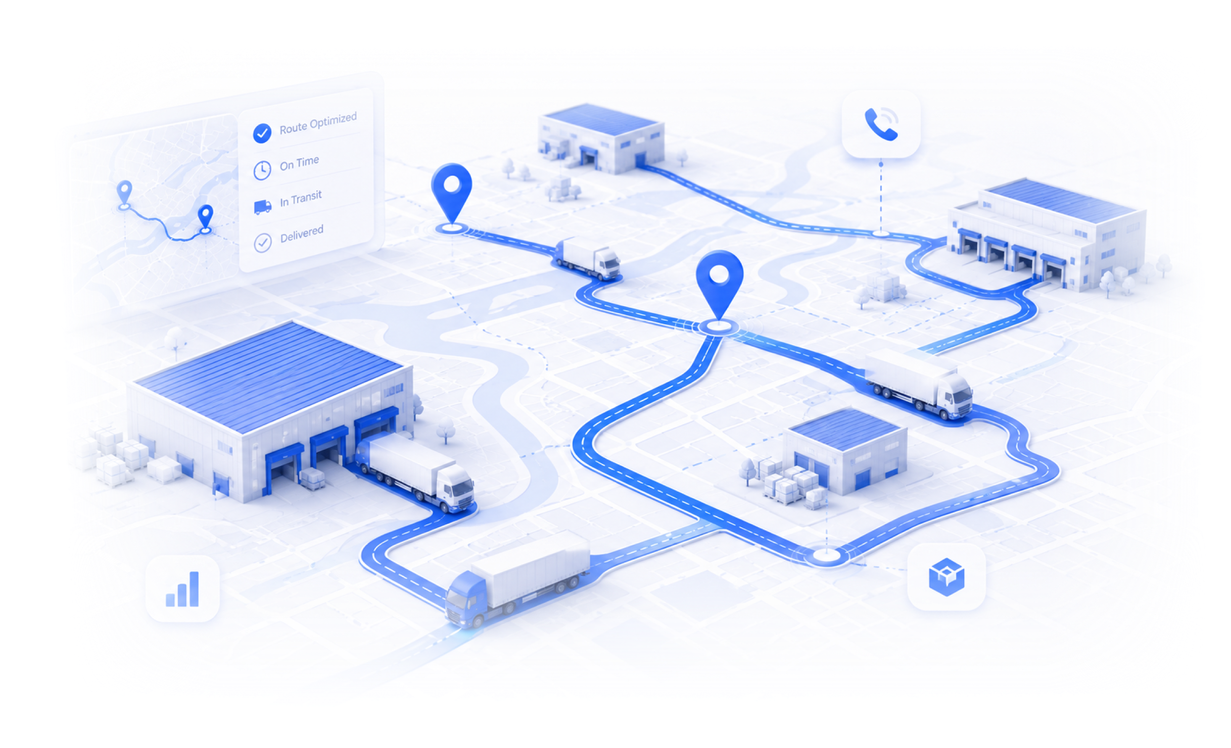
Every coverage decision, every network expansion, every operational call has a location attached to it. BigGeo makes sure you have the data to get it right before it costs you.

You're making network decisions without the full picture.

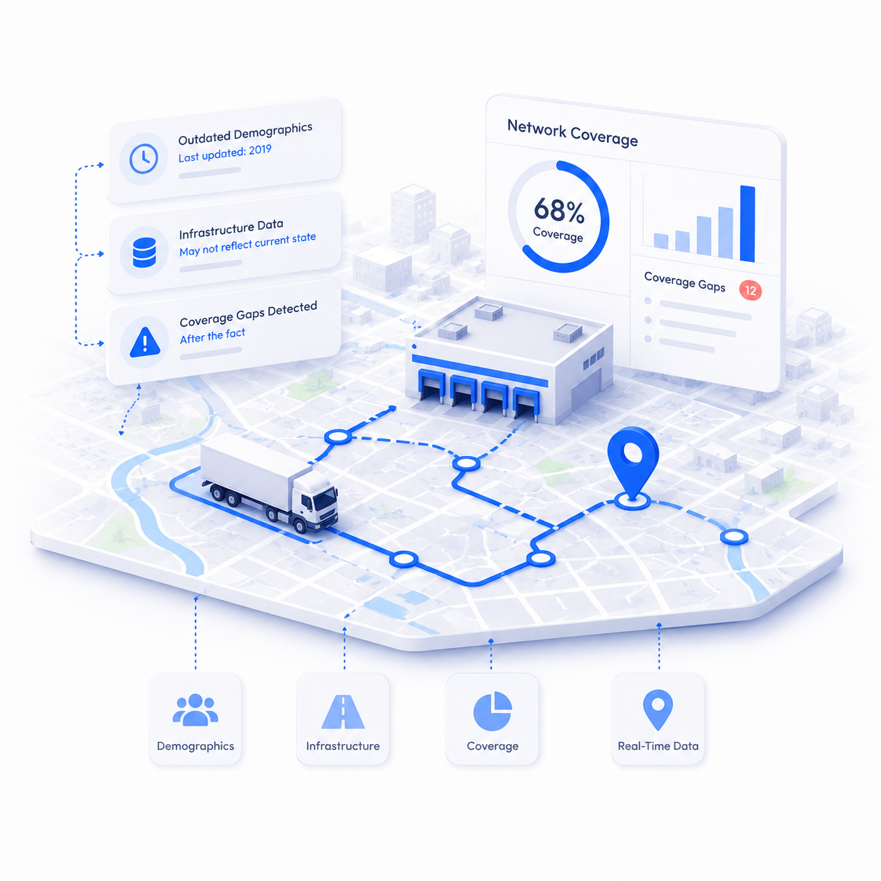
Logistics teams are routing fleets, planning depots, and expanding coverage based on incomplete location data, demographics pulled from outdated sources, infrastructure data that doesn't reflect what's on the ground, and coverage gaps that only show up after the decision is made. By the time the real picture emerges, the lease is signed and the routes are set.

What if network planning was just...asking?

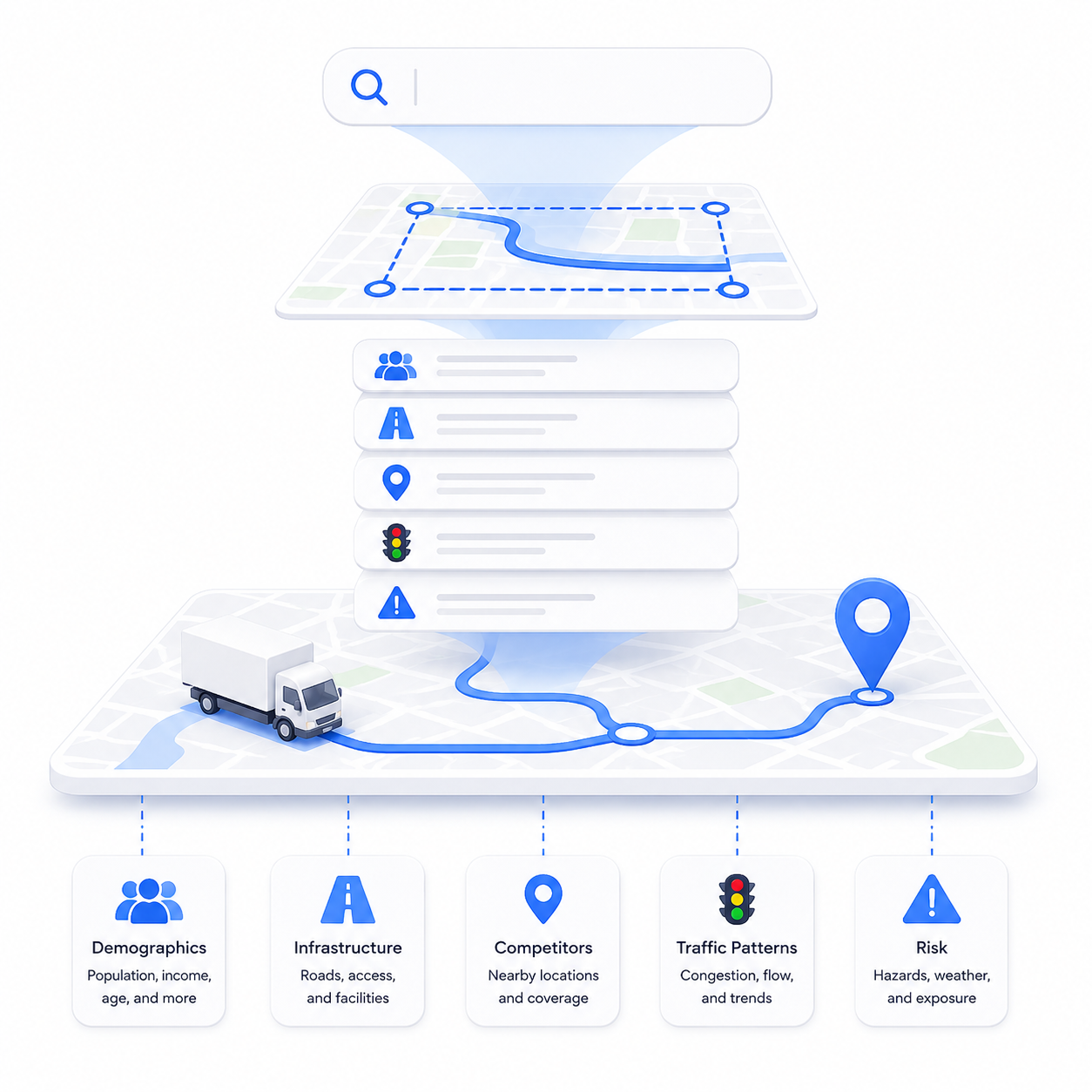
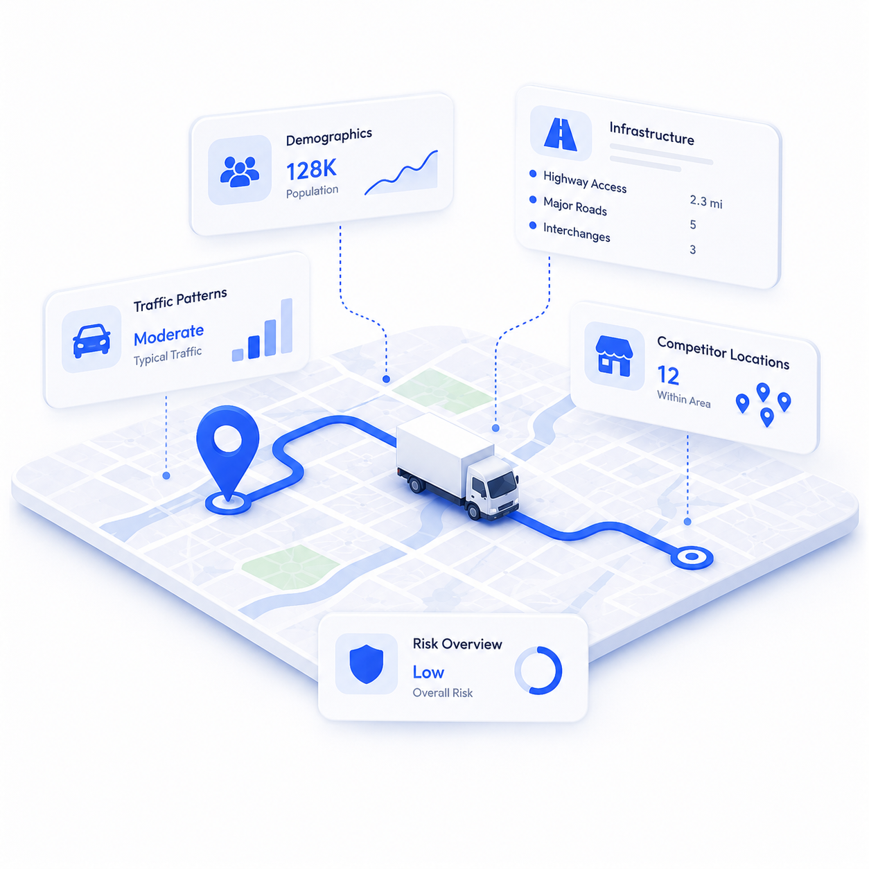
Type an address, corridor, or coverage zone. Get back demographics, infrastructure, competitor locations, traffic patterns, and risk data in seconds. Bring your own fleet and delivery data, use ours, or both. No GIS specialist. No manual data pulls. No waiting

Real decisions. Real results.

storefront
Depot and hub location planning
A logistics operator expanding into a new region needs to evaluate candidate depot locations by road network access, labor market demographics, competitor proximity, zoning classification, and infrastructure availability — across dozens of sites at once. BigGeo runs the full assessment in a single query. What used to take a planning team three weeks takes seconds.
family_home
Last-mile coverage optimization
A delivery network needs to identify coverage gaps, underserved zones, and high-density areas that justify new routing investment. BigGeo maps the full picture across any geography, population density, delivery demand signals, infrastructure constraints, and competitor coverage, in one query. No manual zone mapping. No spreadsheet stitching.
activity_zone
Fleet risk and route assessment
A fleet operator planning routes through new territories needs to assess road conditions, infrastructure risk, weather exposure, and regulatory constraints along every corridor. BigGeo returns the full risk profile for any route in seconds, so decisions get made before the truck leaves, not after something goes wrong.
FAQ

Common questions from real estate teams

What kind of logistics data can I buy on BigGeo Marketplace?
add
Do I need a GIS team or technical background to use BigGeo?
add
Can I use my own fleet and delivery data in BigGeo?
add
Do I have to license a national dataset or can I just buy the coverage area I need?
add
Can I access BigGeo AI through ChatGPT or Claude?
add

Stop planning routes blind. Start knowing.

Bring a coverage area or route you're actually evaluating. We'll show you what BigGeo knows about it.

Book a Meeting
arrow_forward