This is some text inside of a div block.
account_balance
Government
arrow_forward

Better public decisions start
with better location data.

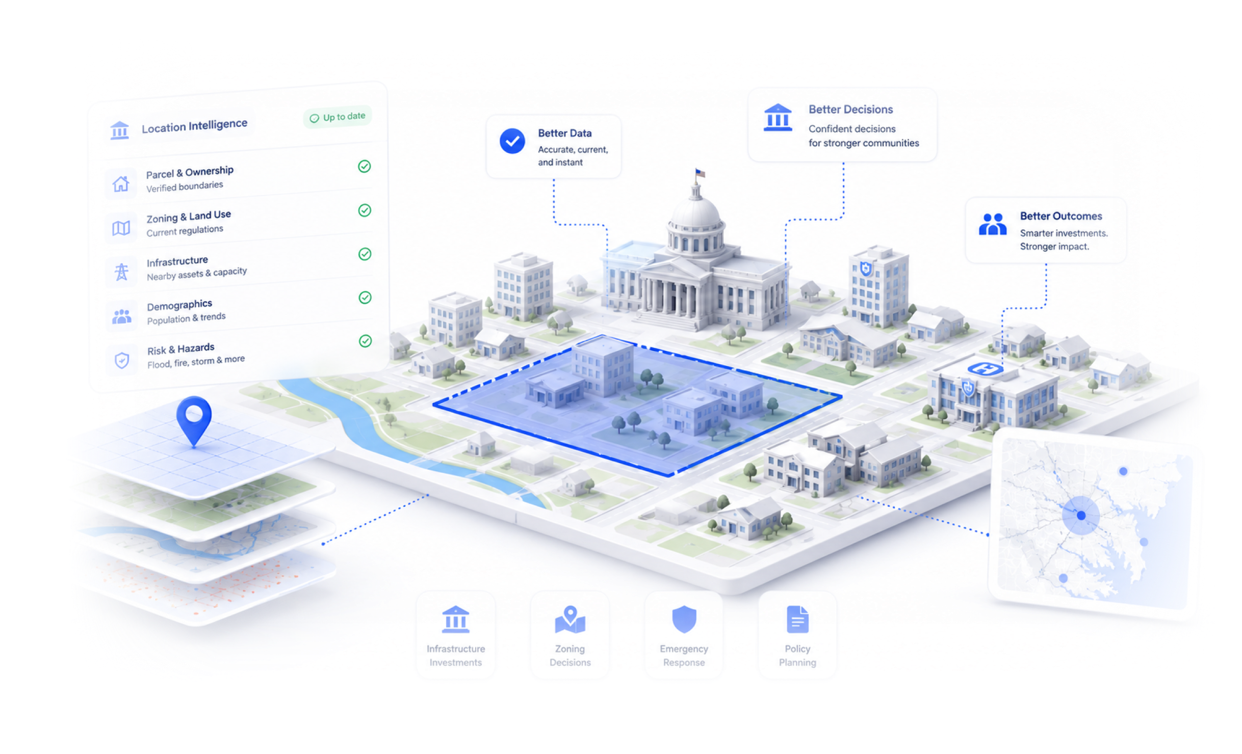
Every infrastructure investment, every zoning decision, every emergency response, every policy call has a location attached to it. BigGeo makes sure the data behind it is accurate, current, and instant.

Public data exists. Accessing it shouldn't take this long.

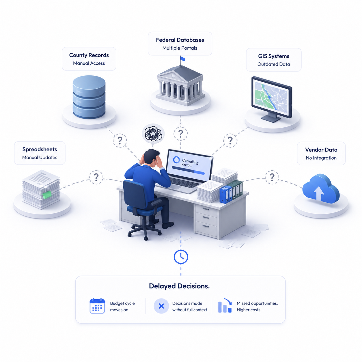
Government teams are making infrastructure, planning, and policy decisions by manually pulling from county records, federal databases, GIS systems that haven't been updated in years, and vendors that don't talk to each other. Analysts spend weeks assembling what should take minutes. By the time the picture is complete, the budget cycle has moved on, or the decision gets made without it.

What if serving the public started with asking the right question?

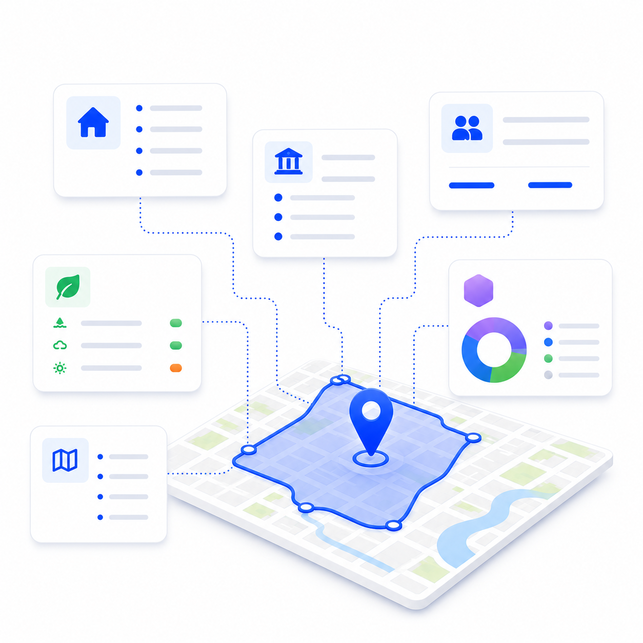
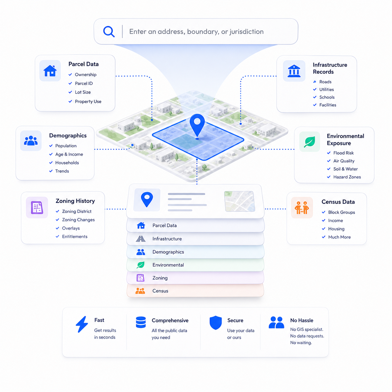
Type an address, boundary, or jurisdiction. Get back parcel data, infrastructure records, demographics, environmental exposure, zoning history, and census data in seconds. Bring your own agency data, use ours, or both. No GIS specialist. No inter-agency data requests. No waiting.

Real decisions. Real results.

storefront
Urban planning and zoning
A city planning department evaluating rezoning applications needs parcel boundaries, ownership history, current zoning classifications, infrastructure proximity, demographic data, and environmental constraints, across multiple sites simultaneously. BigGeo returns the full picture in a single query. What used to require weeks of manual GIS work and inter-department data requests takes seconds.
family_home
Infrastructure investment prioritization
A state agency allocating infrastructure budget across a region needs to rank candidate projects by population impact, existing infrastructure condition, environmental risk, and demographic need. BigGeo maps the full assessment across every candidate geography at once, so investment decisions are backed by data, not instinct.
activity_zone
Emergency management and disaster response
An emergency management team assessing exposure ahead of a weather event needs population density, critical infrastructure locations, flood zones, road network vulnerabilities, and evacuation route conditions, for a specific affected boundary. BigGeo returns the full risk profile instantly, so response resources get deployed where they're needed most.
FAQ

Common questions from government teams

What kind of government data can I buy on BigGeo Marketplace?
add
Do I need a GIS team or technical background to use BigGeo?
add
Can I use our own agency data in BigGeo?
add
Do we have to license a national dataset or can we just access our jurisdiction?
add
Can I access BigGeo AI through ChatGPT or Claude?
add

Stop making public decisions on incomplete data.

Bring a jurisdiction or project boundary you're actually evaluating. We'll show you what BigGeo knows about it.

Book a Meeting
arrow_forward